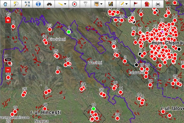
National Disaster Observatory Information System (NDOIS)
UNDP Moldova with support of Bureau of Crisis Prevention and Recovery and VEC has developed the project “Disaster and Climate Risk Reduction” using the Giscuit platform. The objective of the project is to contribute to the reduction of disaster and climate risk in Moldova.
-
Giscuit helps achieve the following goals:
- Disaster and climate risk assessment capacities strengthened and priorities identified at the national level to inform country disaster risk and climate risk management strategies and program development;
- Vulnerabilities reduced and capacities strengthened to manage climate risks at local level;
- Strengthened capacity of UN Country Team to manage disaster and climate risks.
Agency for Energy Efficiency, Moldova
The project aims to create a single system for collecting, processing and continuous update of data and information related to energy efficiency and renewable energy sources - providing a comprehensive and accurate picture of energy resources and their use for energy conversion. Based on the collected data, reports can be prepared that will help identify and prioritize the actions of all stakeholders: central, local authorities, development partners and investors.
Ministry of Environment, Moldova
The project aims to inventory the network of solid waste landfills (DMS) in Moldavian Central Region, Moldavian Northern Region and Gagauzia and develop a geospatial database of DMS deposits in Moldova. Giscuit was applied to improve the workflow processes, from data gathering and analysis to publication and distribution of findings.
Agency of Land Relations and Cadastre of Moldova
For the purposes of centralized accounting, keeping and use of topographical, geodetic and mapping documents there has been created State Cartographical and Geodetic Fund storing the respective materials for the whole territory of the Republic of Moldova. These materials are of technical, scientific, economic, historical, social and cultural interest. Topographical, geodetic and mapping materials and data are distributed for use to public authorities and private sector on demand, observing the Fund Regulations.
Agency of Land Relations and Cadastre of Moldova decided to use Giscuit for their geoportal.md project for it's ability to serve large amount of data under high load, multi language support, excellent public access module, private access for companies and ministers to specific data using role based access. At the moment the geoportal.md is used by Ministry of Transport and Road Infrastructure, Ministry of Environment and Ministry of Internal Affairs via the web browser, WMS and WFS protocols.
Municipal Hall of Chisinau, Moldova
Municipal Hall of Chisinau Moldova uses Giscuit to optimize the work flow of creating geo-data and deploying it to private companies and other municipality departments. Municipal Hall of Chisinau has chosen Giscuit because most of a needed features where already there like browser based authenticated access, versioned editing, publishing, searching, getting information about a feature and printing.
Additional features where developed to integrate into the municipality work flow like statistical overview of data usage, tools for managing municipality's raster map at scale 1:500 that is constantly updated, management system for topographical and geological authrorizations. All geo-data was systematized and converted from local projection to MOLDREF99.
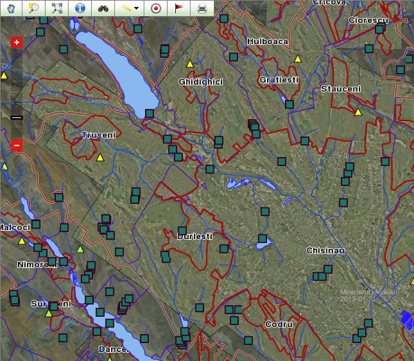
Fire Rescue Department of Chisinau, Moldova
Fire Rescue Department of Chisinau Moldova uses Giscuit to manage the fire hydrants database and help react faster to exceptional situations. In Moldova fire hydrants are underground in man holes and a map with fire hydrants status plus an address plan is crucial to quickly find where should the fire brigade can connect to a water source. The data about fire hydrants was collected by surveyors and introduced in the system using web-based versioned feature editing.
At the moment the operator from the fire department can quickly find the place on the map using search by address and identify the nearest working fire hydrant.