Installation and Configuration
Preparing for installation on Linux PHP interpreter Preparing for installation on Microsoft Windows PostgreSQL and PostGIS Python PIL Giscuit Installation Database General Map Administrator account Sign up options External paths Uninstallation Linux Microsoft Windows Patching Linux Microsoft Windows Change license IntroductionThis section will guide you through the general configuration and installation of Giscuit on various operating systems. Be sure to investigate any sections specific to your platform or web server before you begin the process. You will need to create an account in order to activate the software with a trial or full license. Preparing for installation on LinuxWe currenty support the following linux distributions:
PHP interpreterInstall the PHP interpreter by executing the following command in the terminal: Red Hat Enterprise Linux 5/CentOS 5: yum install -y php53-cli wget sudo # If you get errors about php53-common conflicting with php-common # delete the old php version with the following command: "yum erase php-common" Red Hat Enterprise Linux 6/CentOS 6: yum install -y php-cli wget sudo Ubuntu Server: sudo apt-get install -y php5-cli SUSE Linux Enterprise 11: sudo zypper mr -e SLES11-SP1-Pool sudo zypper remove php53 sudo zypper install php5 openSUSE sudo zypper install php5 Download the installation php script, and execute it from a terminal. wget http://downloads.giscuit.com/giscuit-1.4.3-linux.install sudo php giscuit-1.4.3-linux.install After the installation of the required software is completed, proceed with Giscuit Installation. Preparing for installation on Microsoft WindowsGiscuit runs on all Microsoft Windows platforms. To install Giscuit on windows you will need to download the following components:
Extract giscuit-windows-1.4.3.zip package into the C: directory, you should have C:\ms4w directory after extracting. PostgreSQL and PostGISRun the postgresql-*-windows.exe install file and follow the instructions of the installation process. Set the PostgreSQL installation directory. 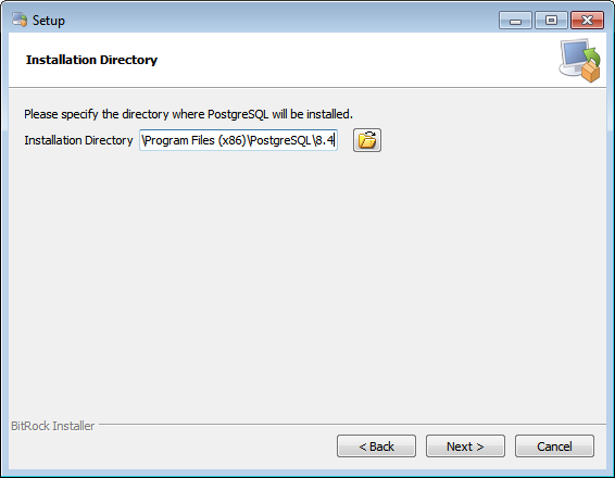
Provide a password for the database superuser "postgres". Database username is postgres and Database password is the one you specified. 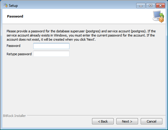
Select the port number the server should listen on, Database port. 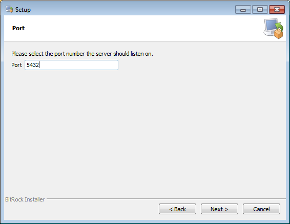
Select the locale to be used by the new database cluster. 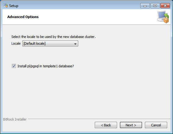
Upon finishing the installation launch the Stack Builder. 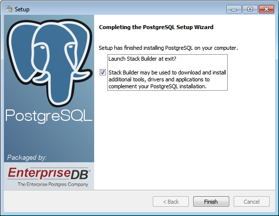
Select your PostgreSQL installation. 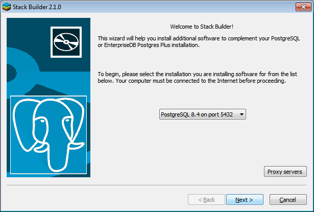
On the Category select screen open the Spatial Extensions tab and select PostGIS 1.5. Choose a mirror close your server location. 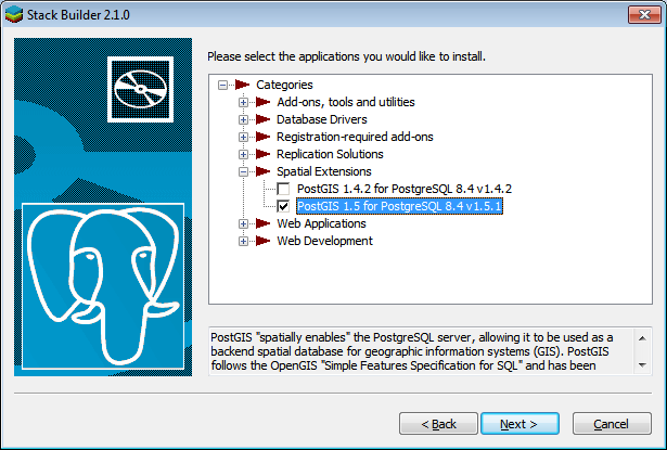
Select all componenets. 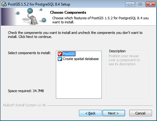
Set the PostGIS installation directory, leave the value of this field as proposed in order to install shp2pgsql.exe into PostgreSQL bin directory. 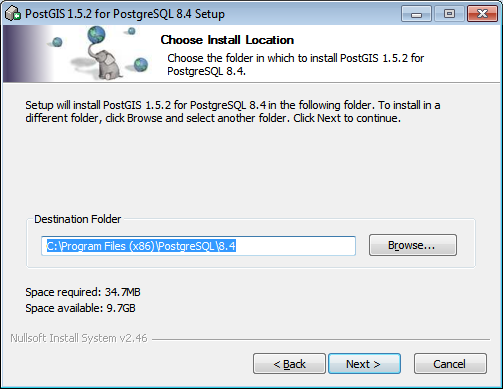
In the database connection section specify "postgres" as the Database username and the Database password you specified during PostgreSQL installation process. 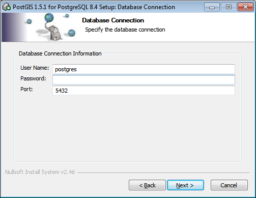
In the database name section specify the name for your spatial database, Database name. 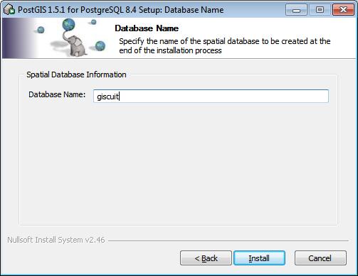
Enable shp2pgsql graphical plugin. 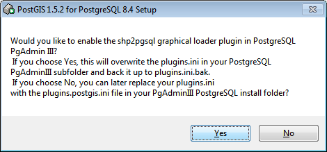 PythonRun the python-2.6.6.msi and follow the installation instructions. Check Install for all users option. 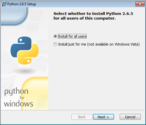
Do not change the destination directory, Leave it as is (C:\Python26\) 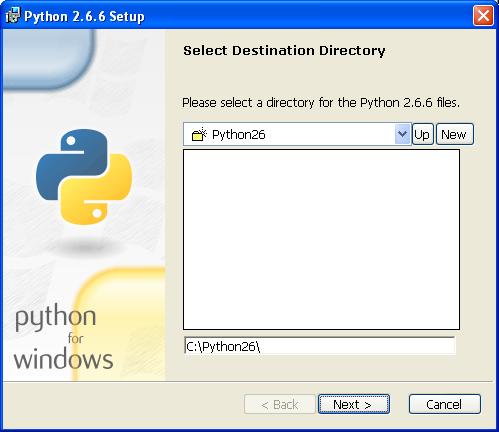 PILRun the PIL-1.1.7.win32-py2.6.exe and follow the installation instructions.  GiscuitOpen C:\ms4w\Apache\conf\extra\httpd-vhosts.conf with your favorite text editor and change the domain name and server administrator e-mail. <VirtualHost *:80>
ServerAdmin YOUR_EMAIL
#Comment bellow line out If you don't have a domain name
#assigned to your network's card IP address
ServerName YOUR_DOMAIN
</VirtualHost>Right click on C:\ms4w\apache-install.bat and "Run as Administrator" to start Apache as a service. If above did not work try the following:
WARNING, the instalattion process will bind the LICENSE KEY to YOUR_DOMAIN and YOUR_IP_ADDRESS and YOUR_MAC_ADDRESS. For example, if you want Giscuit to be accesible from www.example.com you should run the installation process from example.com After the installation of the required software is completed, proceed with Giscuit Installation. InstallationAfter the installation of the required software is completed access http://YOUR_DOMAIN/install.php to start Giscuit installation process. If you don't have a domain name you can use one of your network's card IP address, note that you can not use localhost or 127.0.0.1. WARNING, the installation process will bind the LICENSE KEY to YOUR_DOMAIN and YOUR_IP_ADDRESS and YOUR_MAC_ADDRESS. For example, if you want Giscuit to be accessible from www.example.com you should run the installation process from example.com Note: If you get a "License not found error" after a successful install most likely the page got cached by your browser, press CTRL+R to fix this problem. DatabaseDatabase name. Use the value you specified during PostGIS installation Username. Use the value you specified during PostgreSQL installation Password. Use the value you specified during PostgreSQL installation Host. Database hostname or ip address, default value is "localhost" Port. Use the value you specified during PostgreSQL installation Schema. Schema name where all Giscuit related tables will be created GeneralDate format. Date formats: ISO 8601:
Time zone. Your server time zone HTTP Path. This should be left blank by default, only use this if you installed in a non root directory of your virtual host. For example if you installed in /var/www/test and your document root is /var/www then you can access your install by http://YOUR_DOMAIN/test but you need to set the http path to "/test" MapSpatial reference system identifier. Your map's projection EPSG ID, search for it at spatialreference.org. This projection will be used to display your data in the web browser. Minimum horizontal coordinate. World bound in WGS 84 (EPSG:4326) is -180. World bound in Mercator (EPSG:3857) is -20037508 Minimum vertical coordinate. World bound in WGS 84 (EPSG:4326) is -90. World bound in Mercator (EPSG:3857) is -20037508 Maximum horizontal coordinate. World bound in WGS 84 (EPSG:4326) is 180. World bound in Mercator (EPSG:3857) is 20037508 Maximum vertical coordinate. World bound in WGS 84 (EPSG:4326) is 90. World bound in Mercator (EPSG:3857) is 20037508 Resolutions. The system is designed to display each of its layers at different levels of resolution. Defaults resolutions values:
This article will help you understand map resolutions: http://msdn.microsoft.com/en-us/library/aa940990.aspx Geodata units. Set your projection's map units.
Measurement units. Set measurement units used by measure distance tools.
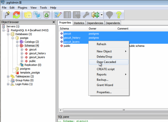
Watermark. Activating this will watermark the map of a logged user and private WMS with his first name, last name and current date Administrator accountUsing this information a new administrator will be created. Use this account to further configure Giscuit. Account (E-mail). Password. Confirm password. First name. Last name. Sign up optionsDefault group. Indicate which user role (group) will be assigned by default to the new user Activate on sign up. Select False to make user deactivated or True to make user activated after submitting sign-up request for registering in the system External pathsThis section is available only on Microsoft Windows platform. MS4W path. MS4W installation directory, default value is "C:\ms4w" PostgreSQL bin path. PostgreSQL bin directory (installation directory plus bin folder), default value is "C:\Program Files\PostgreSQL\8.4\bin" UninstallationLinuxNote: Default Install path "/var/www" and Install name "giscuit" are used in the examples. Remove Giscuit files sudo rm -dr /var/www/giscuit Remove Apache virtual host Ubuntu: sudo a2dissite giscuit sudo rm /etc/apache2/sites-available/giscuit Others: rm /etc/httpd/conf.d/giscuit.conf Remove PostgreSQL user and database (using default Database username "giscuit" and Database name "giscuit"). sudo su postgres dropdb giscuit dropuser giscuit exit Microsoft WindowsRemove Giscuit files. Right click on C:\ms4w\apache-uninstall.bat and "Run as Administrator" to stop Apache service. Delete the C:\ms4w folder. Remove Giscuit data located in a PostgreSQL database. Lauch PgAdmin III (Start -> All Programs -> PostgreSQL 8.4 -> PgAdmin III) and login using your Database username ("postgres" by default). Drop cascaded all schemas starting with Database schema ("giscuit" by default) in the Database name ("postgis" by default).
You can remove PostgreSQL, PostGIS, Python, PIL from the Add or Remove Programs in the Control panel. PatchingLinuxNote: Default Install path "/var/www" and Install name "giscuit" are used in the examples. Note: Before patching it is recommended to backup /var/www/giscuit directory (raster and public/tiles folder can be skipped because they are usually very large) and backup the PostgreSQL database. cd /var/www/giscuit # Change directory wget http://downloads.giscuit.com/patches/giscuit-X.X.X-to-X.X.X-patch-linux.zip # (http://downloads.giscuit.com/patches/) unzip giscuit-X.X.X-to-X.X.X-patch-linux.zip # Unzip cp -r giscuit-X.X.X-to-X.X.X-patch-linux/* giscuit/ # Copy, /bin/cp to avoid interactive mode Go to http://YOUR_DOMAIN/patch.php to complete the patching process. Microsoft WindowsNote: Before patching it is recommended to backup C:\ms4w directory (Apache\htdocs\giscuit\raster and Apache\htdocs\giscuit\public\tiles folder can be skipped because they are usually very large) and backup the PostgreSQL database. Download the patch and extract it. Copy the ms4w folder from the arhive directory into the C: directory, at the "Copy File" prompt select "Copy and Replace" Go to http://YOUR_DOMAIN/patch.php to complete the patching process. Change license
COPYRIGHT ® 2012, VEC |